| Typ <itemType> |
Dokument |
| Datering <presTimeLabel> |
1938 |
| Text i dokument <itemDescription> |
-
CEations uns 2 ov Zz common observations to make clear the development of the conti- nental glaciation, the local movements of the inland ice and the conditions of its recession and also the local glaciation, Special attention should be paid to the problem of the upheaval of the land; all the raised beaches will be exactly levelled, in order to get a epeirogenetic spectrum of Iabrader (ef. appendi...
Visa hela
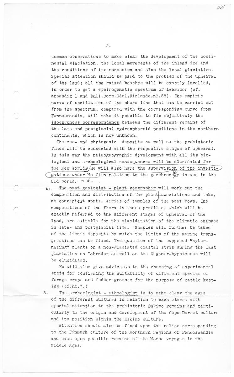
CEations uns 2 ov Zz common observations to make clear the development of the conti- nental glaciation, the local movements of the inland ice and the conditions of its recession and also the local glaciation, Special attention should be paid to the problem of the upheaval of the land; all the raised beaches will be exactly levelled, in order to get a epeirogenetic spectrum of Iabrader (ef. appendix 1 and Bull.Comm.Géol.Finlande,n0,88). Tne empiric curve of oscillation of the shore line that can be carried out from the spectrum, compareu with the corresponding curve from Fennoscandia, will make it possible to fix objectively the isockronous correspondence between the different remains of the late and postglacial hydrospheroid positions in the northern continents, wich is now unknown. Tne zoo- and pkytogenic deposits as well as the prekistoric finds will be connected with the respective stages of upheaval. In tnis way the paleogeographic development with all its bio- logical and archeological consequences will be elucisated for tne New Worlds/He will also have the supervis: of the investi- No TfTA relation to the Beockrondy in use in tho 018 Worlå.— YI. Tne peat geologist - plant geogravher will work out the composition and distribution of tne ASS end take, at convenient spots, series of samples of the psat bogs. Tne compositions of the flera in these profiles, which will be exactly referred to the different stages of upheaval of the land, are suitable for the elucidatation of the climatic changes in late- and postglacial time, Samples will further be taken of the limnic deposits by wnich the limits of the marine trans- sressions can be fixed. The question of the supposed "hyber- nating" plants on a non-glaciated coastal strip during the last glaeiation on Labrador, as well as the Wegener-hypotheses will te elucidatcd, Ec will also sive advice as to the ehoosing of experimental spots for confirming the suitability of different species of forage crops and fodder grasses for the purpose of cattle keep- ing (ef.n0.7.) The archeclogist - ethnologist is to meke clear the ages of the different cultures in relation to each other, with speciel attention to tke prehistoris Dskimo remmins and parti- oularly to the origin and development of the Cape Dorset culture and its position within the Eskimo culture. Attention should also be fixed upon the relics corresponding to the Finmerk culture of the Northern regions of Fennoscandia and even upon possible remains of the Norsc voyages in the Niddle Ages.
Stäng
|
| Text i dokument <itemDescription> |
-
0303 stress will be laid on the practieadility of cultivating green fodder tnat skould enable a rational cattle kecping of the Northern Fennoseandia, type. Thesc operations must & on for a period of t...
Visa hela
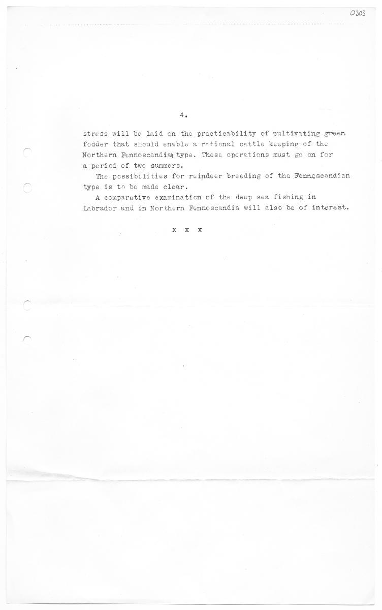
0303 stress will be laid on the practieadility of cultivating green fodder tnat skould enable a rational cattle kecping of the Northern Fennoseandia, type. Thesc operations must & on for a period of twc summera, Te possibilities for reindeer breeding of the Fennoscondian type is tn be made elear. A comparative examination of the decp sea fisning in Isbrador and in Northern Fennoscandia will also be of interest.
Stäng
|
| Text i dokument <itemDescription> |
-
tion to this the nocessary series of samples must be collected In nåt from all tke biogenctie doposits and prohistorie remains whieh can be of ce in reconstrueting the palcogsosraphical development of...
Visa hela
tion to this the nocessary series of samples must be collected In nåt from all tke biogenctie doposits and prohistorie remains whieh can be of ce in reconstrueting the palcogsosraphical development of assist Librador. Grankull: - Finland, 1938. Mama
Stäng
|
| Text i dokument <itemDescription> |
-
osor 282 2180 underwent changes, i.e. its geocentrie distance alternately in- ertased and decreased, If the upward movement of tho surface of the sen at ”s erust, there occurred a ons place was more r...
Visa hela
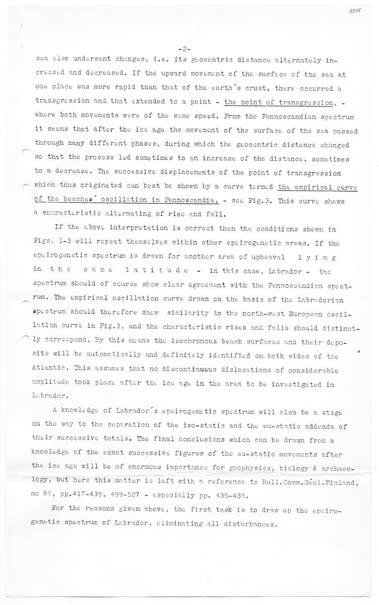
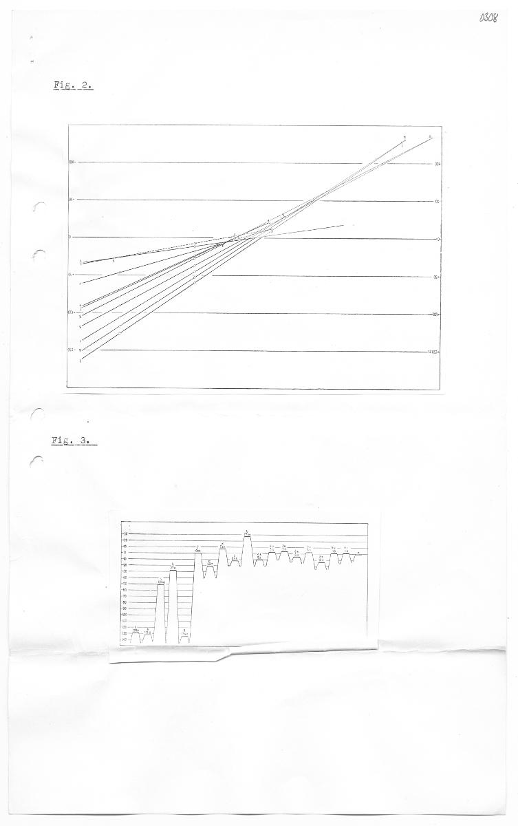
osor 282 2180 underwent changes, i.e. its geocentrie distance alternately in- ertased and decreased, If the upward movement of tho surface of the sen at ”s erust, there occurred a ons place was more rapid than that of the earth transgression and that oxtended to a point - the point of transgression, - where both movements were of the same speed. From the Fennoscandian spectrum it seems that after the ice age tae movement of the surface of the sca passcd tarough many different phascs, during which the geocontric distance ckanged so that the process led sometimes to an increase of the distance, sometimes to a decrease. Tne successivce displacements of the point of transgrossion which thus originated can best be shown by a curve tormed the empirical curve of the beaches” osetllation in Fennoscandia, - sce Fig.3. Tnis curvc shews a eharactoristie alternating of rise and fall. If the above interpretation is correct then the conditions shewn in Figs. 1-3 will repeat themsolvcs within other epeirogenstic areas. If the epefrogenctic spectrum is drawn for another area of upheaval 1 ying in the same latitude - in this case, Labrador - tho spectrum should of course skow clear agroement with tne Fennoscandian spect- rum, The empirical oscillation curve drawn om the basis of the Iebradorian spectrum should tacrcfore show similarity to the norta-west European oseil- lation curve in Fig.3, and the characteristic rises and falls should äistinct- 1y sorrospond. By this means tac isochronous beach surfaces and their Acpo- sits will be automatically and definitely identified om both sides of tne ions of considerable Atlantic. This sssumes that no discontinucus disloen amplitude took placc after the ies age in the aren to be invostigated in Iabrador. A knowledec of Labrador”s epeirogenttic spsctrum will also be a stage om the way to the separation of the iso-static and the eu-static addenda of their succossive totals., Tne final conclusions which can be äram from a knowleåge of the exect successive figures of the eu-static movements after the ieo ago will be of enormous importance for gcophysics, biology & archaeo- logy, bat hero this mtter is left with 3 reference to Bull.Comm.GÉol. Finland, no 85, pp.417-439, 499-527 - especially pp. 435-439 For the reasons given above, the first task is to draw up the epciro- genetic spectrum of Labrador, eliminating all disturbances.
Stäng
|
| Text i dokument <itemDescription> |
-
2 0303 The ethnologieal material eencerning the Eskimos and if v possible also the Naskaupi-Iniians Ao be completed. --The investigations mentioned above (1,2 and 3) will, during the first sumtner, de...
Visa hela
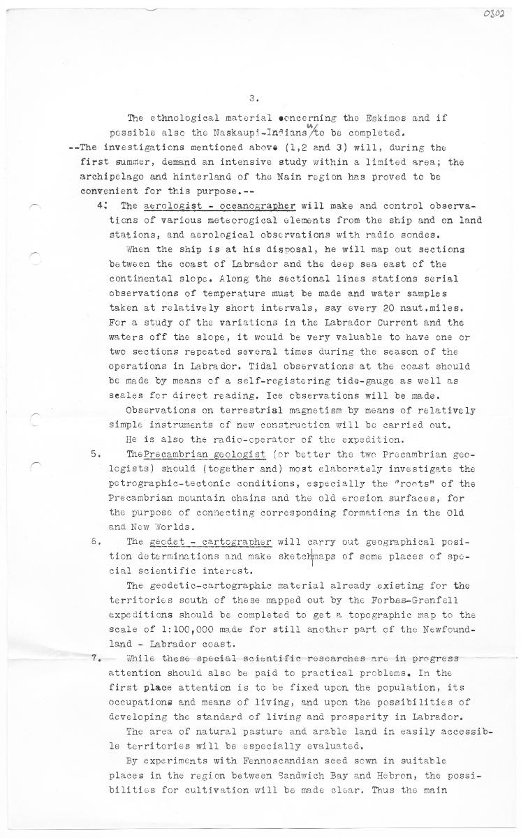
2 0303 The ethnologieal material eencerning the Eskimos and if v possible also the Naskaupi-Iniians Ao be completed. --The investigations mentioned above (1,2 and 3) will, during the first sumtner, demand en intensive study within a limited area; the archi pelago and hinterland of the Nain region has proved to be convenient for this purpose.-- 4: The aerologist - oceanographer will make and control observa- ticns of various metcorogiecal elements from the skip and on land stations, and aerological observations with radio sondes. When the ship is at his disnosal, he will map out sections between the coast of Isbrador and the deep sea east of the eontinental slopc. Along the sectional lines stations serial observations of temperature must be made and water samples taken at relatively short intervals, say every 20 naut.miles. For a study of the variations in the Labrador Current and the waters off the slope, it would be very valuable to have one or tvo sections repeated several times during the season of the operations in Labrador. Tidal observations at the coast should be made by means of a self-registering tide-gauge as well as seales for direct reading, Ice observations will be made. cans of relatively simple instruments of new construction will be carried out. He is also the radio-cperator of the expedition. MePrecambrian goologist (or better the twa Procambrian geo- legists) should (together and) moat elaborately investigate the Petrographic-tectonte conditions, especially the "rote" of the Precambrian mountain chains and the old erosion surfaces, for the purpose of comnecting corresponding formations in the Old and New Worlds. The geodet - cartographer will carry out geographical posi- sketolneps of some places of spo- Observations on terrestrisl magnetism by m tion determinations and m eial scientific interest. The geodetic-cartographic material already existing for tho territories south of these mapped out by the Forbes-Grenfell expeditions should be completed to get a topographie map to the scale of 1:100,000 mide for still another part of the Newfound- land - labrador coast. hile tacse special scicntiffe researches are in progress attention should also be paid to practical problems. In the first place attention is to be fixed upon the population, its occupations and means of living, and upon tne possibilities of developing the standard of living and prosperity in labrador. The area of natural pasture and arable land in easily accessib- 16 territories will be especially evaluated. able places in the region between Sandwich Bay and Hebron, the possi- bilities for cultivation will be made elcsar. Thus the main By experiments with Fennoscandian seed som in sui
Stäng
|
| Text i dokument <itemDescription> |
|
| Text i dokument <itemDescription> |
-
OM et A. The quarternary geological investigation in labrador aims at deciding the exact chronological connection between the late glacial and tie post - elacial formations within the North Atlantic c...
Visa hela
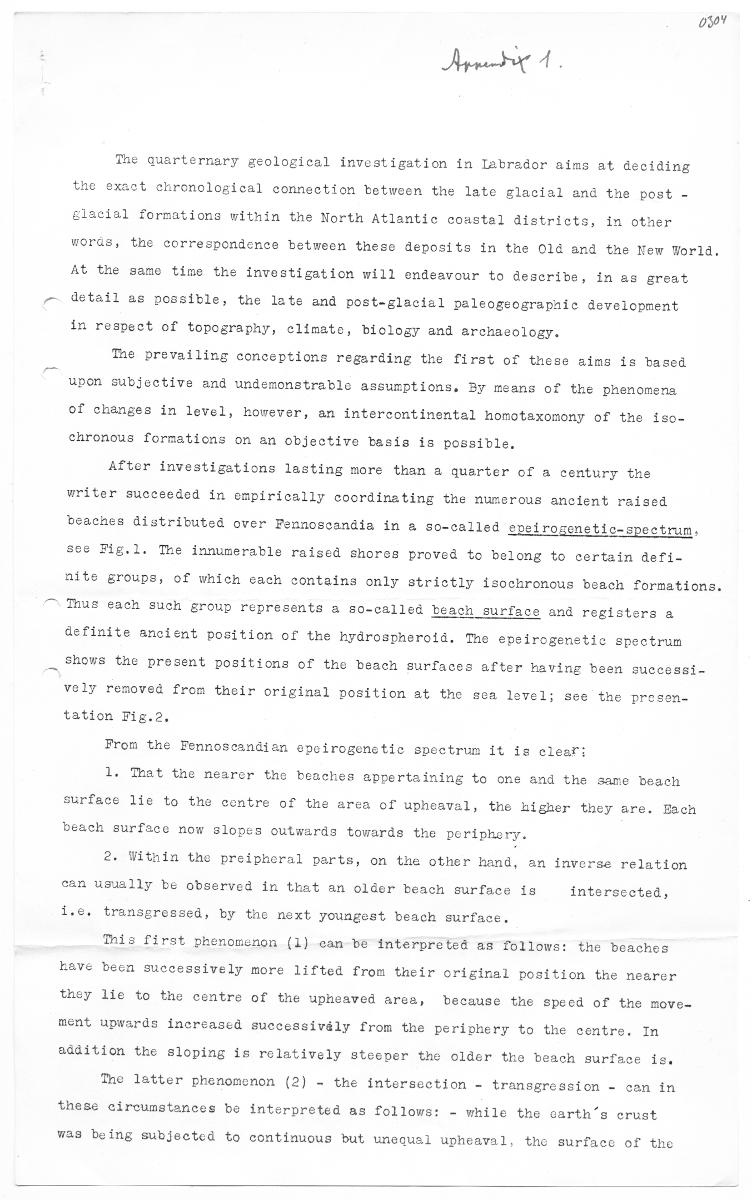
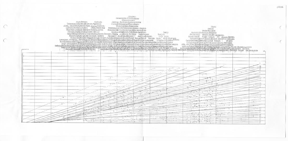
OM et A. The quarternary geological investigation in labrador aims at deciding the exact chronological connection between the late glacial and tie post - elacial formations within the North Atlantic coastal districts, in other woras, the correspondence between these deposits in the Old and the New World. At the same time the investigation will endeavour to describe, in as great detail as possible, the late and post-glacial paleogeograpaic development in respect of topography, climate, biology and archaeology. Tne prevailing conceptions regarding the first of these aims is based upon subjective and undemonstrable assumptions. By means of the phenomena of changes in level, however, an intercontinental homotaxomony of the iso- ehronous formations on an objective basis is possible. After investigations lasting more than a quarter of a century the writer succeeded in empirically coordinating the numerous ancient raised beaches distributed over Fennoscandia in a so-called epeirogenetic-spectrum. see Fig.l. The innumerable raised shores proved to belong to certain defi- nite groups, of which each contains only strictly isochronous beach formations. Thus each such group represents a so-called beach surface and registers a gefinite ancient position of the hydrospheroid, The epeirogenetic spectrum shows the present positions of the beach surfaces after having been successi- vely removeå from their original position at the sea level; see the prosen- tation Fig.2 From the Fennossandian epoirogenetic spectrum it is clear: 1. That the nearer the beaches appertaining to one and the same beach ourface lies to the centre of the area of upheaval, the higher they are. Bach beach surface now slopes outwards towarde the periphery 2. Witnin the proipheral parts, on the other hand, an inverse relation san usually be observed in that an older beach surface is intersected, i.e, transgressed, by the next youngest beach surface. nia first enomenon (1) can be interpreted as follows: the beaches kave been successively more lifted from tneir original position the nearer they lie to tac centre of the upheaved area, because the speed of the move- ment upwards increased successivåly from the perishery to the centre. In h surface is. addition the sloping is relatively steeper the older the bea Tne latter phenomenon (2) - the intersection - transgression - can in these circumstances be interpreted as follows: - while the carth's erust vas being subjected to continuous but unequsl upheaval, the surfacc of the
Stäng
|
| Text i dokument <itemDescription> |
-
0300 Scheme for the Projecteå Expedition to Labrador 1939-1940, The purpose of the expedition during the summers of 1939-and 1940 will be to carry out the scientific and practical research in Labrador...
Visa hela
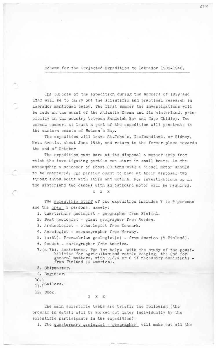
0300 Scheme for the Projecteå Expedition to Labrador 1939-1940, The purpose of the expedition during the summers of 1939-and 1940 will be to carry out the scientific and practical research in Labrador mentioned below, The first summer the investigations will be mde on the coast of the Atlantic Ocean and its hinterland, prin- eivally in the country between Sandwich Buy and Cape Ohidley. The at least a part of the expedition will penetrate to the eastern coasts of Hudson's Bay. The expedition will leave St.John's, Newfoundland, or Sidney, Nova Scotia, about June 15th, and return to the former place towards the end of October The expedition must have at ite disposal a mother ship from weich the investigating parties can start in small boats. As the notnexfsnip a schooner of about 60 tons with a diesel motor should to be'chartered. Tae parties ought to have at their disposal two second summer strong ships boats with sails and motors. For investigations up in the hinterland two canoes with an outboard motor mill be required. xxx The scientific staff of the expedition ineludes 7 to 9 persons and the erew 5 persons, namely: 1. Quarternary geologist - geographer from Finland. 2. Peat geologist - plant gecgrapher from Sweden. 3. Areheologist - ethnologist from Denmark. » Aerologist - occanogrepher from Norway. 5. (a+5b). Precambrian geologist(s) - from America (& Finland). 6. Geodet - cartographer from America. 7.(a+7b), Assistants, The lst helpe with the study of the possi- bilities for agricultureand cattle keeping, the ond for general matters, with 2,3,4 or 6 if necessary assistants - from Finland (& America). 8; Shipmaster. 9. Engineer. 20.7 11.1 Saflorsi 12. Cook. xxx The main scientific tasks aro briefly the following (the program in detail will be worked out later individually by the scientific particivants in the expedition): 1. Tne quarternary geologist - geographer will make out all the
Stäng
|
| Händelse <context> |
|
| Nyckelord <itemKeyWord> |
-
E1A-16_0300
-
E1A-16_0300-0308
-
E1A-16_0301
-
E1A-16_0302
-
E1A-16_0303
-
E1A-16_0304
-
E1A-16_0305
-
E1A-16_0306
-
E1A-16_0307
-
E1A-16_0308
|
| Typ av dokument<itemName> |
- brev
|
| Ämne <subject> |
|
| Arkivdokument-ID <itemNumber> |
|
| Tidigare identitet <itemNumber> |
|
| Tidigare identitet <itemNumber> |
|
| Tidigare identitet <itemNumber> |
|
| Tidigare identitet <itemNumber> |
|
| Tidigare identitet <itemNumber> |
|
| Tidigare identitet <itemNumber> |
|
| Tidigare identitet <itemNumber> |
|
| Tidigare identitet <itemNumber> |
|
| Tidigare identitet <itemNumber> |
|
| Rättigheter för metadata <itemLicense> |

|
| Källa <presOrganization> |
Statens museer för världskultur - Östasiatiska museet |
|
Källa <url>
|
|

 ARTIKLAR I WIKIPEDIA
 ARTIKLAR I WIKIDATA
 BILDER I WIKIMEDIA COMMONS


